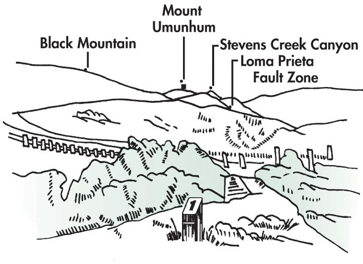
Using the associated photo, try to identify Loma Prieta, a mountain 23 miles to the southeast near the site of the 1989 earthquake. Loma Prieta is located on the American plate, underlying most of North America and half of the Atlantic Ocean. You are now standing on the eastern edge of the Pacific plate. The San Andreas Fault, located along Stevens Creek Canyon, is the boundary between the Pacific and American plates. Look at the large boulders at your feet. This particular type of rock, which is called a conglomerate, came from a unique source - the flanks of Loma Prieta, 23 miles away! About 2 million years ago, water carried these boulders from Loma Prieta westward across the San Andreas Fault and deposited them on the Pacific plate. Since then, successive slips along the San Andreas Fault have slowly shifted the Pacific plate in a northwesterly direction, bringing the boulders to their present position. By looking at the landscape, you’ll find clues that you are in a fault zone. One clue is the shallow, but significant depression below, just north of the parking lot. In the winter, this depression, called a sag pond, catches water and becomes a marsh. Aside from human-made stock ponds, there are only two types of places in the coastal range where ponds are found: fault zones and landslide areas. When you see a pond in this area you know it must have been created fairly recently. In this case, by the 1906 earthquake. Sag ponds like this one indicate that the earth’s crust was stretched, allowing parts of the hillside to sink. Notice the line of posts with white stripes on the other side of the sag pond. They mark a minor fault within the San Andreas fault zone that moved slightly in 1906.
