Add your organization to OuterSpatial. Get started now for free.
image.jpg

Maunalaha Trail

Trail in Honolulu Watershed Forest Reserve

0 Reviews

Report

Report incorrect or missing information.

Details

Length (one way): 0.7 mi / 1.13 km - Elevation Change: 500 ft / 152.4 m

General Summary:

Maunalaha trail begins around Hawai‘i Nature Center moving into the valley and serves as beginning junction to the other trails in the Makiki area.

For additional information refer to the "Route description" below.

Additional Information

Allowed Access
Dogs
Pedestrians
Activities
Dog Walking
Hiking
Accessibility
Wheelchair Accessible
Rules & Regulations
Carry Out Trash
Dogs On Leash
No Biking
Pack Out Dog Waste
Stay On Trail
Activities

  • Accessible
  • Dog Hunting
  • Dogs on Leash
  • Hiking

Features

  • Cultural Study
  • Nature Study
  • Open Views
  • Stream

Hazards

  • Dangerous Cliff
  • Dangerous Footing
  • Falling Rocks
  • Uneven Surface

Prohibited

  • No Alcohol
  • No Bicycles
  • No Commercial
  • No Littering
  • No Plant Sand Dirt Rock Removal
  • No Smoking

Terrain and Trail Environment

Mixed forest and tree types, dry rocky ridge line.

Dog Owners

Hunting may be in progress on or near this hiking trail. Hunting dogs may be off-leash while engaged in the hunt. Hikers must keep their dogs leashed at all times and remove dog waste while on this trail.

History

Shortly after the establishment of the Honolulu Forest Watershed Reserve in 1919, Territorial Forestry constructed the Maunalaha Trail to connect the old Makiki Station (now the forestry baseyard) to a small nursery below Pu`u Kakea (Sugarloaf). In 1915 forestry crews built the Makiki Valley Trail, which provided access from the nursery to nearby watersheds for planting tree seedlings.

Plants & Birds

The Cook pines along the lower section of the Maunalaha Trail probably date from reforestation efforts in the 1930s by the Civilian Conservation Corps. Named after Captain James Cook, the pines are native to New Caledonia (Isle of Pines) in the South Pacific between Fiji and Australia. They are columnar in shape and have overlapping, scalelike leaves about 1/4 inch long, rather than true needles.

Special Conditions

Hikers must keep their dogs leashed at all times and remove dog waste while on this trail. Do not use any trail or access road that is not delineated by name and color and that may also be displayed on these maps. The marked features are managed for public recreational use. Other trails or roads that branch off from the public features may be on private property, and are not managed for any public recreational use. Access is subject to adjacent landowner approval, and if used without authorization, you will be trespassing and possibly putting yourself at risk. Downloadable resources are provided below

Simple Trail Tips:
  1. Stay on the trail. 
  2. Check the weather 
  3. Watch the time 
  4. Avoid undue risk 
  5. Read all posted signs 
  6. Respect other trail users 
  7. Pack out at least what you pack in.
Amenities

  • Bench
  • Bridge
  • Drinking Water
  • Interpretive Signs
  • Parking
  • Picnic Pavilion
  • Picnic Table
  • Restroom
  • Trash Cans
  • Visitor Center
  • Water Fountain

Route Description

The trail begins behind the Hawai‘i Nature Center. It crosses a bridge and proceeds left past several taro lo‘i. After one switchback, the trail steeply climbs the east ridge of Makiki Valley. This is were the trail inherited the name "Roots and Rocks". The trail is hard to define in many areas, so just stay on the ridge and you are on the trail. At about 0.7 miles the trail comes to a 4-way intersection. The extreme right route is the Ualaka‘a Trail and it takes you to the Ualaka‘a State Park. The mauka (mountain) route takes you to the Moleka Trail Trail head as well as Round Top Drive. The left route is the Makiki Valley Trail, which drops down in the valley, and then goes back up to Tantalus Drive. You can also take this route, cross the valley until you get to an intersection, turn left and proceed makai (ocean) on Kanealole Trail. This route forms a loop which will take you back to the Hawai‘i Nature Center and Division of Forestry and Wildlife Baseyard. Stay on the trail. Pack out at least what you pack in. No open fires. The first bridge is wheelchair accessible

Descriptions for route, history, plants and birds were provided by Stuart Ball, author of The Hikers Guide to Oahu and other hiking books

Directions

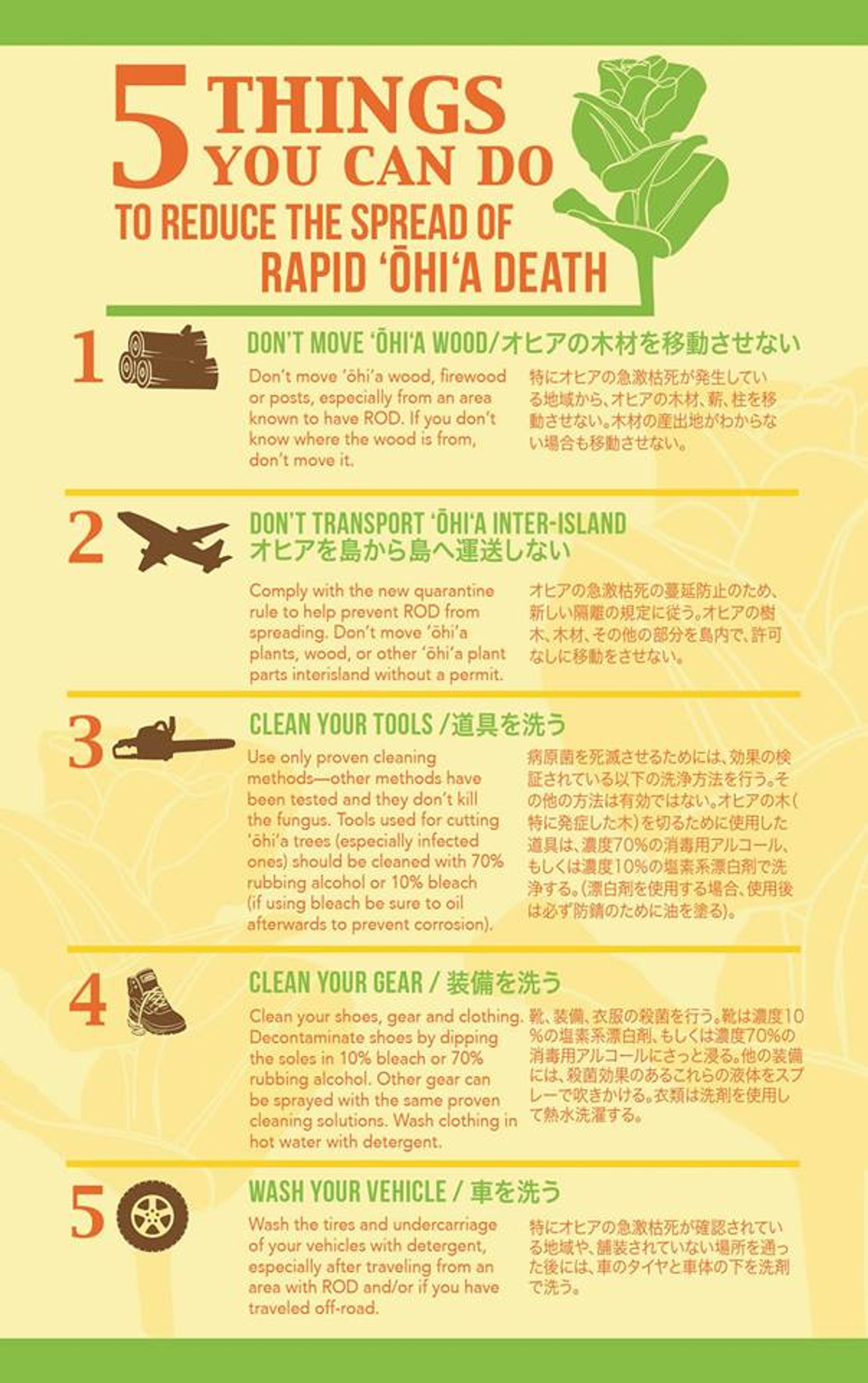
If driving from the intersection of Nehoa and Makiki Streets, proceed mauka and turn left on Makiki Heights Drive. Proceed for approximately 0.5 mile until the road makes a sharp left turn (look for a row of mailboxes on the right side of the road). Proceed straight ahead past the mailboxes through a green gate. There is a sign that says, "Makiki Forest Recreation Area." Continue shortly up the road till you see a gravel parking lot on your left. Parking for the trail is available in this lot. Proceed up the road on foot till you reach a stone building (public restroom) on your right. Turn right just before the building and the trail head begins right after the bridge.

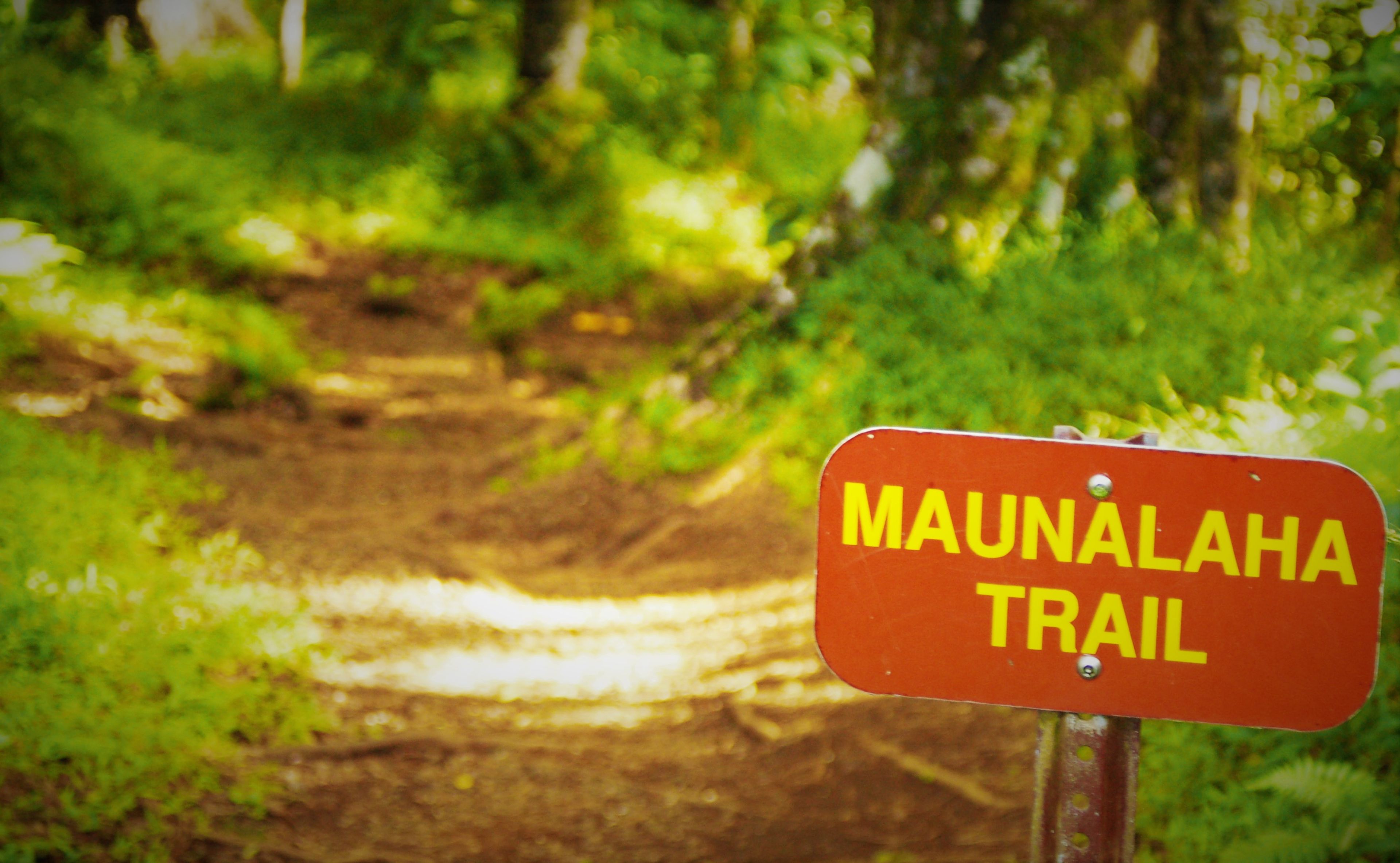
Please note that the Maunalaha Trail (in yellow) is part of the Honolulu-Mauka Trail Network, comprising of 18 interconnected trails (in turquoise). The system may be accessed via the Makiki Arboretum Trail (dark blue) as part of an extended hike. The shortest route from the Makiki Arboretum Trail to the Maunalaha trailhead is 0.25 miles.

From the gravel parking lot continue along the paved road on foot. After passing Hawai`i Nature Center on the right, reach a signed junction. Turn right on a driveway leading to the Kanealole and Maunalaha Trails. Pass restrooms, a boot cleaning station, and a drinking fountain. Cross Kanealole Stream on a bridge and turn left upstream on a gravel path. Nearby is a bulletin board with trail information. Pass several lo`i (kalo or taro terraces) on the left. Reach another signed junction by a bench and several Cook pines. Turn right onto the Maunalaha Trail. Ascend a side ridge on two switchbacks following a line of pines. Gain the ridgeline and climb steeply through a eucalyptus forest. The Maunalaha Trail ends a signed junction with the `Ualaka`a and Makiki Valley Trails. Nearby is a posted trail map and a bench.