Add your organization to OuterSpatial. Get started now for free.
image.png

Ma‘akua Ridge Trail

Trail in Hau‘ula Forest Reserve

0 Reviews

Report

Report incorrect or missing information.

Details

Length (one way): 2.5 mi / 4.02 km - Elevation Change: 800 ft / 243.84 m

Ma‘auka Ridge Trail is a loop trail that begins in thick hau forest. The forest quickly opens up and the trail is mostly in open, dry country. After crossing the stream, the trail begins to switchback up the ridge, quickly reaching a shelter and two benches. The shelter and benches overlook Hau‘ula and the ocean. Just past the shelter, the trail splits. Go either way - it forms a loop.

The trail traverses around the ridge, dropping down into some gulches along the way. The trail offers some great views of the ocean and Hau‘ula town. This trail traverses a public hunting area - hikers should exercise caution. Wear bright colored clothing and be aware that you may encounter hunters who may be hunting off trail - stay on the trail. Descriptions for route, history, plants and birds were provided by Stuart Ball, author of The Hikers Guide to Oahu and other hiking books

Additional Information

Allowed Access
Bicycles
Dogs
Activities
Dog Walking
Hiking
Mountain Biking
Road Biking
Wildlife Watching
Rules & Regulations
Carry Out Trash
Dogs On Leash
No Motorized
No Motorized Wheeled Vehicles
Pack Out Dog Waste
Stay On Trail
Features
  • Nature Study
  • Open Views
Terrain and Trail Environment

Mountainous, diverse forest types

Special Conditions

Do not use any trail or access road that is not delineated by name and color and that may also be displayed on these maps. The marked features are managed for public recreational use. Other trails or roads that branch off from the public features may be on private property, and are not managed for any public recreational use. Access is subject to adjacent landowner approval, and if used without authorization, you will be trespassing and possibly putting yourself at risk.

Simple Trail Tips

1. Stay on the trail.

2. Check the weather

3. Watch the time

4. Avoid undue risk

5. Read all posted signs

6. Respect other trail users

7. Pack out at least what you pack in.

Activities
  • Archery
  • Bicycle
  • Camping
  • Dog Hunting
  • Dog on Leash
  • Hiking
  • Pedestrian
  • Tours
  • Wildlife view
Amenities & Facilities
  • Bench
  • Campsites
  •  Picnic table
  • Shelter
Mountain Bikers

Always yield to hikers. Do not slide around corners or slide down the trail. Careless mountain biking damages the trail and causes erosion. If accidents are reported or damage to the trail is extreme, the trail may be closed to mountain bikers.

Dog Owners

Hunting may be in progress on or near this hiking trail. Hunting dogs may be off-leash while engaged in the hunt. Hikers must keep their dogs leashed at all times and remove dog waste while on this trail.

Hazards
  • Dangerous Footing
  • Hunting Area
Plants and Birds

On the trail, look and listen for the white-rumped shama. It is black on top with a chestnut-colored breast and a long black-and-white tail. The shama has a variety of beautiful songs and often mimics other birds. A native of Malaysia, the shama has become widespread in introduced forests such as this one. Look for native papala kepau trees in Papali Gulch. They have large, leathery, oval leaves and clusters of small, white flowers. Early Hawaiians smeared glue from the sticky, ripe fruit on poles to catch native birds for their feathers. Craftsmen then fashioned capes and religious objects from the bright red and yellow feathers. On the return portion of the Papali loop, watch for the sprawling native shrub `ulei in the sunny sections. It has small, oblong leaves arranged in pairs; clusters of white, roselike flowers; and white fruit. Early Hawaiians ate the berries and used the tough wood for making digging sticks, fish spears, and `ukeke (the musical bow).

History

In the early 1930s Territorial Forestry built the Ma`akua Gulch – Papali loop to provide access to the Hau`ula Forest Reserve for tree planters, pig hunters, and fence builders. Trail crews started digging out the loop in August 1932 finished it in December of that year. Civilian Conservation Corps workers re-graded and cleared both loops in 1935.

Directions

First try to click on the “Get Directions” icon at the top of this page. If you are take TheBus, click on the "Transit" icon at the top of the search bar. you may need to change the starting address to your current location. Clicking on TheBus link provided below will also take you to TheBus website.

If driving from Kamehameha Highway at Hau‘ula, turn onto Hau‘ula Homestead Road (across from Hau‘ula Beach Park). When the road makes a sharp curve to the left, continue straight onto the access road. Park along the road before the cable gate. Continue on foot past the gate and the hunter/hiker check in station. Ma‘akua Ridge Trail begins on the left side of the access road, past Hau‘ula Trail (which is on the right).

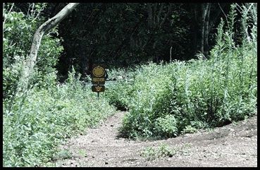
Go around a yellow gate and pass a private driveway on the left. The road forks by a utility pole. Take the left fork and go around another yellow gate. Cross Hanaimoa Stream and swing right to reach a signed junction. Keep left on the paved road. (To the right is the Hau`ula Loop Trail.) Register at the nearby hunter/hiker check-in mailbox. The road straightens out briefly by a concrete retaining wall. Before the road curves right, reach a second signed junction. Bear left and down off the road onto the Ma`akua Ridge - Papali Trail. Cross Ma`akua Stream presently and climb the embankment on the far side. Work right and then left through a tangled hau grove. Climb gradually up the side of Ma`akua Gulch on eight switchbacks. After the seventh a short trail leads left to a covered picnic table. At the eighth switchback by a bench, the trail splits to become a loop. Turn sharp right and start the loop in a counterclockwise direction. Switchback four more times and then steadily ascend mauka up the side of the ridge through mixed introduced forest. Reach the ridgeline and stroll along it under shady Formosa koa trees. By a large, yellow strawberry guava tree, reach a junction. Bear left off the ridge and descend gradually into Papali Gulch. Cross the stream by a stand of ki (ti) shrubs and turn left downstream. Climb gradually out of the gulch, which is lined with kukui trees. Gain the narrow ridgeline briefly near a tall Cook pine and a mango tree. Switch to the right side of the ridge and descend along the side of Punaiki Gulch on a series of twin switchbacks. Break out into the open through `ulei, a sprawling native shrub. Contour around the front of the ridge under arching Christmas berry trees. Descend once again into Papali Gulch to the stream and turn right. Follow the rocky streambed briefly and then angle left onto the trail. Climb out of the gulch on four switchbacks, and then contour along the front of the next ridge. At the end of the loop bear right and down. Retrace your steps to the paved road and follow it back to your car.

Overview

  • Get Directions
    4493.73 mi Away
  • Lat/Lng
    21.60581, -157.91697
  • Length
    2.47 Miles